Air Raid Shelters in Audley Parish
by Clive Millington
updated 23 November 2015
Shelters identified so far.
Alsagers Bank
The Drive
Audley
Booth Street
Chester Road
Church Street, by Butchers Arms
Church Street, private shelter still standing by no.106 [photo in ACN no.45]
Hall Street [photo]
![[photo]](/World Wars/shelters/VE Day Hill Terrace.jpg)
Hill Terrace
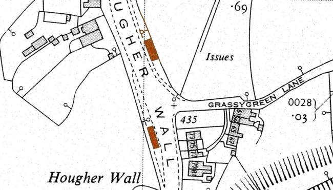
Hougher Wall, 1 block just before and 1 block opposite Grassy Green Lane map
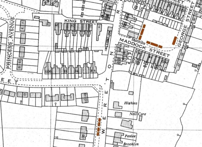
King Street
Maddock Street [photo in ACN no.43]
Mellard Street
Wereton Road, just past Queen Street [photo] map
Bignall End
Albert Street
Bignall End Road, by recreation ground
Diglake Street
Hope Street
Ravens Lane, behind Plough Inn
Tibb Street
Chapel Street, on land opposite Ravens Lane School (where the Sunday School and Community Hall was built in 1954). It was used by the children from the school during the daytime.
Eardley End/Dunkirk
12 shelters, 2 still standing [photo]
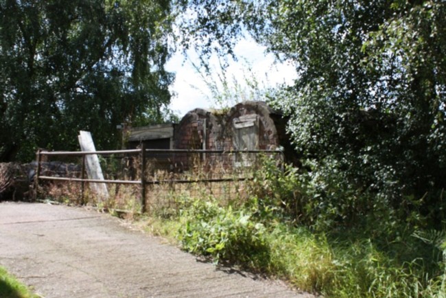
Halmer End
High Street, opposite Wesley Place map
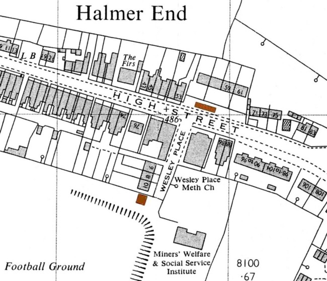
High Street, behind Wesley Place Chapel map
Holding Crescent
Miles Green
Heathcote Road, by brook, on garage side [photo] map
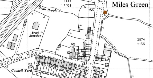
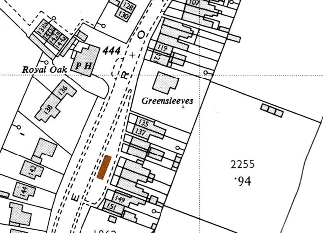
Heathcote Road, outside West Leigh, opposite Royal Oak [photo on Facebook page] open this link in a new tab or new window by right clicking your mouse. Facebook doesn't allow its pages to open within our pages map
Victoria Place
[ACN = Audley Community News]
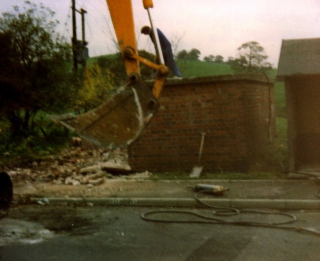
The above list shows the air raid shelters in Audley parish which have been identified to date. There must have been many more. We would welcome any information and especially photographs which people may possess of shelters (or parts of shelters which may appear on other photos).
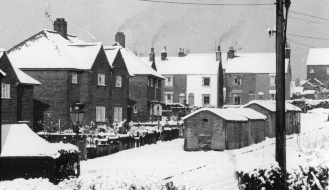
Shelters were erected on spare land in streets or, in the case of streets of terraced housing, actually in the middle or to one side of the road. An example of this is the photograph of the VE Day celebrations in Hill Terrace/Hall Street, Audley, which shows the Hall Street shelter in the background.
As many shelters were demolished soon after the war, they do not appear on any maps. The first post war large scale Ordnance Survey maps of the parish were produced around 1960. However, the shelters are not identified as such on the maps and appear the same as garages, sheds or other small buildings. Shelters can only be identified when their exact positions are known. The maps included here show the shelters still surviving c1960 which have been positively identified. They are marked in brown on the maps.
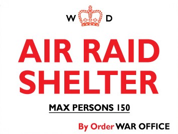
The sign is a typical air raid shelter sign which would indicate the maximum number of persons allowed in each shelter.
Fortunately no bombs fell on the parish during World War 2, but Chesterton was not so lucky. It was bombed in the late afternoon of 14 December 1940 resulting in the deaths of 16 people. An account of the air raid can be found in Audley Historian no.13, published in 2007.